Rødekro
Rødekro (Rothenkrug) is a railway town with a population of 5,950 (1 January 2022), which was the seat of the former Rødekro Municipality (Danish, kommune) in Aabenraa Municipality in Region of Southern Denmark on the Jutland peninsula in south Denmark.
The former Rødekro municipality covered an area of 202 km2, and had a total population of 11,695 (2005). Its last mayor was Tove Larsen, a member of the Social Democrats (Socialdemokraterne) political party.
The municipality was created in 1970 due to a kommunalreform ("Municipality Reform") that combined a number of existing parishes:
* Egvad Parish
* Hellevad Parish
* Hjordkær Parish
* Rise Parish
* Øster Løgum Parish
On 1 January 2007 Rødekro municipality ceased to exist as the result of Kommunalreformen ("The Municipality Reform" of 2007). It was merged with Bov, Lundtoft, Tinglev, and Aabenraa municipalities to form the new Aabenraa municipality. This created a municipality with an area of 951 km2 and a total population of 60,151 (2005). The new municipality belongs to Region of Southern Denmark ("South Denmark Region").
Map - Rødekro
Map


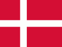
Country - Denmark
 |
 |
| Flag of Denmark | |
As of 2013, the Kingdom of Denmark, including the Faroe Islands and Greenland, has a total of 1,419 islands above 100 m2; 443 of which have been named and of which 78 are inhabited. Spanning a total area of 42943 km2, metropolitan Denmark consists of the northern part of the Jutland peninsula and an archipelago of 406 islands. Of these, the most populated island is Zealand, on which the capital Copenhagen is situated, followed by Funen, the North Jutlandic Island, and Amager. Denmark's geography is characterised by flat, arable land, sandy coasts, low elevation, and a temperate climate. As of 2022, it had a population of 5.928 million (1 October 2022), of which 800,000 live in the capital and largest city, Copenhagen. Denmark exercises hegemonic influence in the Danish Realm, devolving powers to handle internal affairs. Home rule was established in the Faroe Islands in 1948 and in Greenland in 1979; the latter obtained further autonomy in 2009.
Currency / Language
| ISO | Currency | Symbol | Significant figures |
|---|---|---|---|
| DKK | Danish krone | kr | 2 |
| ISO | Language |
|---|---|
| DA | Danish language |
| EN | English language |
| FO | Faroese language |
| DE | German language |